
T Roosevelt NP north unit
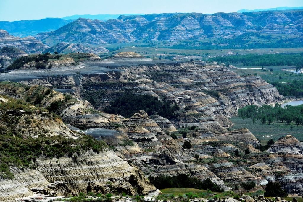
This is the more remote part of the complex. It is about 80 miles from Medora and 30 miles from the closest town, so it’s visitation is far less. This remoteness makes it a favorite of many visitors. The formations are probably a bit more stunning, and the ability to see how the terrain switches from rolling, endless prairie to deep gorges is really something. Unfortunately, my timing forced me to be there at mid-day which is not ideal for photography. But, I was able to get some decent shots to share here.

Vivid formations
View from River Bend Overlook, maybe the most famous view point of the entire park, either north or south units.
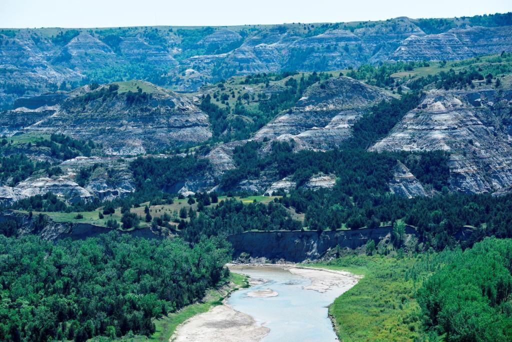
Also from River Bend view point

Little Missouri from River Bend. Do you want a geology lesson? Priors to the last ice age, this river flowed north into Canada and emptied into Hudson Bay. The Ice dammed its path and it took this sharp turn here and flows now eventually into the Gulf of Mexico.


One of a few solitary Bison I saw that day. It was pretty hot and he did not look comfortable.

This shot attempts to show you how the rolling, endless prairie rather immediately and abruptly changes into the badlands of the Little Missouri River.

I had to laugh. I am done with the park, and ready to exit having seen only 2 or 3 bison, and well, how about a trip to the visitor center instead? Looks like the exit is blocked for now. This stalemate went on for 10 minute’s or so until a brave ranger shooed the bison off the road.